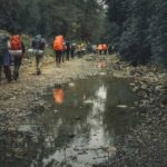

Remote trails can become difficult to follow when weather closes in, vegetation hides the tread, or several faint paths split in different directions. Reliable wilderness navigation for hikers is less about owning one clever device and more about building layers of awareness. A paper map gives you the big picture, a compass gives you direction, GPS can confirm your position, and observation helps you notice when the landscape no longer matches your plan.
Think of Navigation as a Layered System
Good hiking navigation starts before you move. Study the route, identify major terrain features, note likely decision points, and decide what would tell you that you have gone too far. A river crossing, ridge, saddle, junction, lake, road, or steep change in contour can all act as checkpoints. Carry a map that covers more than the exact trail corridor, check daylight and weather, and tell someone your intended route and expected return time.
Use a Topographic Map to Understand the Ground
A topographic map shows far more than trails. Contour lines reveal hills, valleys, ridges, saddles, and slopes. Closely spaced contours indicate steeper ground, while wider spacing suggests gentler terrain. Streams usually occupy valleys, and contour lines crossing a drainage often form a V shape pointing uphill. Learning these patterns lets you compare the map with the land around you.
Orient the Map Before Making Decisions
Orienting a map means rotating it so north on the map matches north in the real world. Use a compass or match obvious terrain features when visibility is good. Once the map is oriented, a ridge shown to your right should actually appear to your right. Check the map scale too, and estimate distance using trail markers, pace, time, or GPS track data. Steep ground and poor conditions can make time alone misleading.
Use a Compass for Direction, Not Just Emergencies
A baseplate compass becomes more useful when you understand the map. The needle points toward magnetic north, while maps are commonly referenced to true north or grid north. The difference is magnetic declination, which varies by location and changes gradually over time. Use a current value for your area rather than assuming an old printed figure is exact.
Taking and Following a Bearing
Set the desired direction on the compass, account for declination as appropriate, then rotate your body until the magnetic needle aligns with the orienting marks. Instead of staring at the compass while walking, choose a visible tree, rock, or opening that lies on your bearing. Walk to it, then repeat. Practise map and compass skills on familiar ground before depending on them in remote country.
Use GPS as a Confirmation Tool
Phones and dedicated GPS receivers work best as part of a system. GPS positioning relies on satellite signals, so a device can often determine your location without cellular service. However, map tiles, route information, messaging, and other app features may require data unless you downloaded them beforehand.
For GPS hiking, download offline maps before the trip, save the planned route, mark important waypoints, and make sure the correct map region is available. Carry enough battery capacity for the expected trip and protect electronics from cold, moisture, and impact.
Do not follow the screen blindly. Digital maps can be outdated, user-generated routes can contain errors, and positioning accuracy can worsen in steep canyons or under heavy cover. If a device suggests a line across a cliff, deep river, or obviously unsuitable slope, stop and reassess.
Build Backup Skills for When Technology Fails
The strongest backup is the ability to remain oriented. Periodically look behind you because trails often appear different in the opposite direction. Notice junctions, rock formations, drainage crossings, and changes in slope. Mentally connect those features to your map so the route becomes a sequence of known places rather than a line you merely follow.
Keep the paper map accessible and protected from rain. Carry a compass you know how to use. Related preparation such as reading a topographic map, backcountry trip planning, and an essential hiking gear checklist can strengthen the same self-reliance skills.
What to Do When You Think You Are Off Route
The worst response to uncertainty is to keep walking quickly and hope the trail reappears. Stop and work from known information. Check your last confirmed location, direction of travel, elapsed distance, elevation, nearby terrain, and recent junctions. Compare those clues with both the map and GPS rather than trusting only one source.
Imagine you cross a broad meadow expecting to meet the trail again near a creek. Ten minutes later, the creek is below you on the wrong side of a small ridge. Instead of descending immediately, identify the ridge on the map. If your route should have remained west of it, the ridge is evidence that you drifted east. Returning toward the last known point may be safer than improvising a shortcut through unknown terrain.
If you are genuinely lost, avoid wandering without a clear reason. Staying near a safe, identifiable location can keep the search area smaller. If emergency assistance is needed and communication is available, provide your coordinates, planned route, condition, and recognizable nearby features.
Common Navigation Mistakes to Avoid
Small errors often combine into bigger problems. A nearly empty phone battery, missing offline maps, ignored declination, an unexpected landmark, or the assumption that every visible path is the official trail can each undermine a trip. Another common mistake is checking location only after confusion begins.
At every meaningful junction or terrain change, ask: Where am I? Where am I going next? What feature should appear next? What would tell me I missed it? That habit turns navigation from an emergency skill into an ongoing part of hiking.
Frequently Asked Questions
Do hikers still need a paper map if they use GPS?
For remote trips, a paper map is a valuable independent backup. It needs no battery and gives you a wide-area view for rerouting and terrain awareness.
Does phone GPS work without cell service?
Usually, yes. A phone can receive satellite positioning signals without a cellular connection, but maps and route details may not display unless they were downloaded for offline use.
How often should I check my position?
Check more often near junctions, in poor visibility, on faint routes, after detours, and whenever the terrain differs from what you expected. Frequent quick checks are easier than correcting a large error later.
What is the most important backup navigation skill?
Terrain awareness is the foundation. Relating ridges, valleys, streams, slopes, landmarks, and direction of travel to a map helps you detect errors even when a device fails.
Make Navigation Part of Every Hike
Wilderness navigation becomes dependable through repetition. Read the map before the trailhead, keep track of major features as you move, use a compass deliberately, and let GPS confirm rather than replace your judgment. Practising these habits on straightforward hikes builds the familiarity you will need when signs vanish, clouds lower, or technology stops cooperating.